Every pilot has had the same day. The forecast says good thermals, the sky looks the way it's supposed to look, and yet you sink out ten minutes off launch while someone across the valley climbs to base. It feels random. It isn't.
Thermals don't happen everywhere. They happen where the ground works hardest — and once you know what to look for, half the sky stops being a mystery. This is the first thing an experienced pilot learns, and the last thing most forecasts show you.
The one-sentence physics
Air near the ground heats up when the sun hits it. Hot air is less dense than cool air. Less-dense air rises. That's the whole story.
Everything else — trigger points, cycle times, thermal drift, cloudbase — is about answering a single question: which patches of ground are heating up fastest, and how does the hot air escape once it does?
What makes a good thermal source
Not all ground heats equally. A rocky south face at midday might reach 50 °C while the pine forest 200 m away sits at 25 °C. That 25-degree contrast is where thermals are born. Here's what to look for, in rough order of thermal-producing power:
| Surface | How well it produces thermals | Why |
|---|---|---|
| Sun-facing rock, scree, cliff bands | Excellent | High heat absorption, low evaporation, releases quickly. Classic Alpine and Andalusian XC engines. |
| Dry, dark plowed fields | Very good | Dark soil absorbs strongly. Common flatland triggers in France, Spain, Italy. |
| Sun-baked road surfaces, parking lots | Good but small | Concentrated hot spots — reliable trigger points but usually thin. |
| Cut hay or dry grass on south slopes | Good | Dries quickly, low thermal mass, releases in cycles. |
| Villages, towns, industrial areas | Good | Roofs, concrete, and human activity — reliable urban thermals in summer. |
| Forests | Poor (weak, delayed) | Trees transpire — energy goes into evaporating water, not heating air. But forest edges can be triggers. |
| Lakes, rivers, wet ground, snow | None to negative | Water absorbs heat without warming much. Snow reflects sun outright. Expect sink over these. |
Understanding which surface you're flying over is 50% of thermal hunting. The other 50% is understanding how the hot air actually leaves that surface.
Triggers: how hot air actually releases
A patch of hot ground doesn't send thermals up continuously — it accumulates, then releases in bursts. Something has to push the bubble off. That "something" is a trigger, and terrain features do most of the triggering:
1. Terrain edges
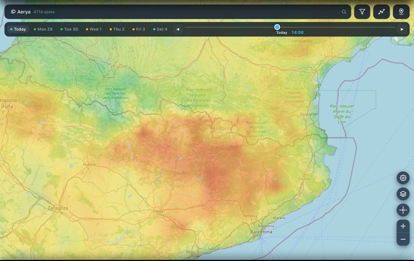
Where a slope suddenly changes angle, or where a sunlit face meets a shaded one, the hot air peels off. Ridge tops, cliff edges, and pinch points along a mountain spine are the most reliable trigger locations in the mountains. This is why so many launches are placed near these features — it's not just for takeoff comfort, it's because thermals are guaranteed.
2. Wind gradients
When wind blows across a hot slope, the meeting point acts like a plow — it scrapes hot air off the ground and forces it upward. This is why light wind days often work better than dead-still days: the wind is doing the triggering work for you. It's also why thermals tend to form on the downwind edge of hot fields in the flatlands.
3. Convergence lines
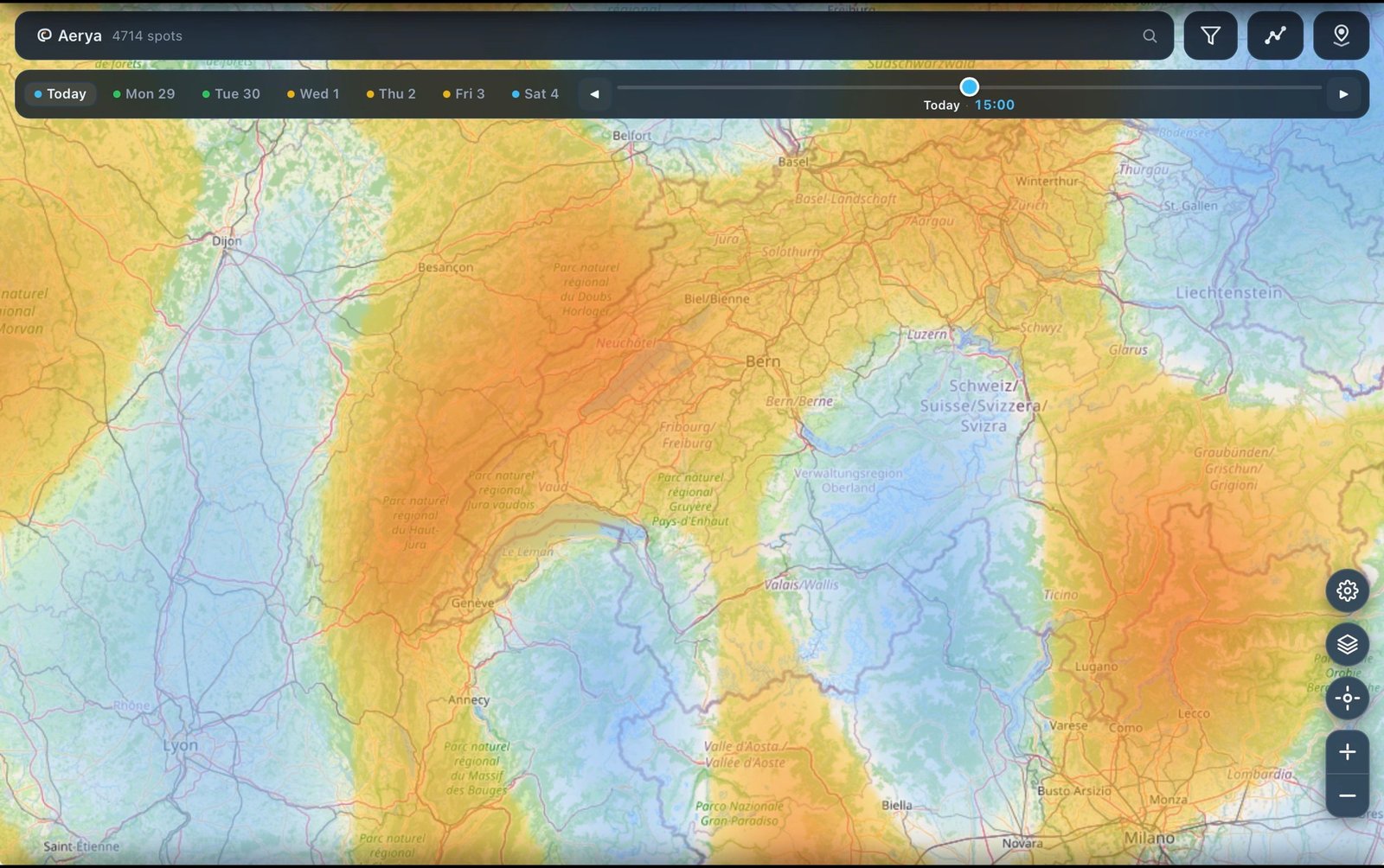
When two winds meet — sea breeze against mountain valley wind, or two valley winds converging on a col — the air has nowhere to go but up. Convergence turns a marginal day into a magic one, and its thermals last far longer than regular ones because the trigger is continuous, not cyclical. We'll cover this in depth in the next article.
4. Local heat contrast
A dark plowed field surrounded by pale wheat, a rocky outcrop poking out of forest, a village in the middle of farmland — any strong contrast in surface type creates a thermal circulation between the hot spot and the cooler ground around it. Look for the boundary and you'll find lift.
Reading sun angle
Sun angle changes everything through the day. A south face gets hit hard from mid-morning through mid-afternoon. A southwest face saves its best hour for late afternoon — often producing the day's strongest, latest thermals. An east face is done by lunchtime.
Practical use:
- Morning flying: east and southeast faces switch on first. Great for early XC starts.
- Midday: south and true-south faces work hardest. Peak thermal window.
- Late afternoon: west and southwest faces still working while the rest of the mountain has already died. This is where late saves happen.
- North faces: shaded and cool. Sink zones. Don't cross above minimum altitude.
Why generic forecasts miss all of this
Most weather models were built for aviation or agriculture — not paragliding. They average conditions across grid cells of 10, 20, or even 25 kilometers. At that resolution, an entire mountain range gets smoothed into a single number, and every face — sunlit or shaded — is treated the same.
For a paraglider pilot, that's useless. You need to know:
- Which specific ridges are producing thermals right now
- How the pattern shifts as the sun rotates through the day
- Where convergence is stacking on top of thermal lift
- Which valleys will decouple and shut down first
Aerya was built to answer these questions at the resolution the terrain actually deserves — using AROME and ICON-D2 (1-2 km grids) combined with real elevation data (SRTM) and surface classification (ESA WorldCover). No pancake averages. What you see on the map is what the terrain is actually doing.
See where thermals form today
Free on iPhone. Terrain-aware thermal, convergence, and wind overlays — no signup required to look.
Download for iPhone →A pilot's checklist before launch
Before you clip in, spend 30 seconds mentally answering these questions. It's the difference between hopping around your home site and covering 100 km:
- Which faces are sunlit right now? Look at the actual sky and terrain, not just the forecast.
- Where are the trigger points? Ridge tops, cliff edges, dark fields, contrast boundaries.
- Where is the wind pushing hot air? The downwind edge of a hot slope is where the release happens.
- Is there convergence along my route? If yes, plan to intercept it — the day's best lift will be there.
- Which faces will still be working in 2 hours? Sun rotates. Plan your route to follow the working ground, not against it.
Do this consistently and something shifts. The sky stops being random. Every good pilot you've watched circle up while you sank out was reading this exact terrain map in their head — they just did it faster than you.
The good news: this is learnable. The better news: you don't have to hold it all in your head anymore.
What's next
- Coming soon: Convergence lines — how to spot them, and how to fly them for cross-country distance
- Coming soon: Reading the daily thermal cycle — when to launch, when to top out, when to head home
- More Aerya guides →