Every pilot has a story about the day everything clicked. Cloudbase suddenly climbed. A line of dark cumulus appeared over the ridge and stayed there. Sink between thermals disappeared. Distances that should have been impossible opened up like a corridor.
What you were flying was convergence. And the difference between good XC pilots and great ones is that great ones don't stumble into it — they see it coming on the forecast, they fly to it, and they stay in it as long as it lasts.
What convergence actually is
The name sounds technical but the idea is trivial. Two air masses come from different directions. They meet. Neither can pass through the other. The only way out is up. That column of rising air is a convergence line.
What makes it magic for pilots is persistence. A thermal is a bubble — it rises, drifts, decays. You catch it, climb, and then you have to find another one. A convergence line is a wall. It just keeps producing lift, hour after hour, as long as the two winds keep feeding it.
In the last article we covered where thermals form. Thermals depend on the ground working hard and the trigger releasing at the right moment. Convergence doesn't care about any of that. It'll happily produce lift over a lake, over shaded terrain, over anywhere the two winds happen to collide.
The three types you'll actually encounter
1. Sea-breeze convergence
The classic. On a warm day, land heats faster than sea. Warm air rises over the land, and cooler sea air flows inland to replace it. That sea breeze pushes inland — and where it collides with the prevailing synoptic wind (or with a mountain-valley circulation), you get a convergence line.
These lines can sit stationary for hours, marked by a row of cumulus that suddenly stops. Fly the "warm" side of the line and you climb. Fly the "cool" side and you sink. The line itself is often the strongest XC engine of the day in coastal ranges — Provence, Andalusia, the Italian coast, southern California.
2. Valley-wind convergence
In mountain terrain, warm daytime valleys generate their own local winds — anabatic flow that runs up the valleys toward the high peaks. When two valley winds meet on a col or a ridge junction, they collide and force air upward. This is why some cols consistently produce huge climbs while similar cols nearby stay dead.
The lift is often narrow and organized — you'll feel it as a beat of continuous positive integrated air rather than a discrete thermal core. Follow the ridge and you can stay in it for miles.
3. Synoptic convergence
Larger-scale — where prevailing winds meet along a trough line, ahead of a front, or downwind of a mountain range. Less common as a daily flying feature, but on the right day these can produce the huge cloud streets that show up on satellite imagery, running for hundreds of kilometers. Convergence at this scale is what makes long-distance XC records possible.
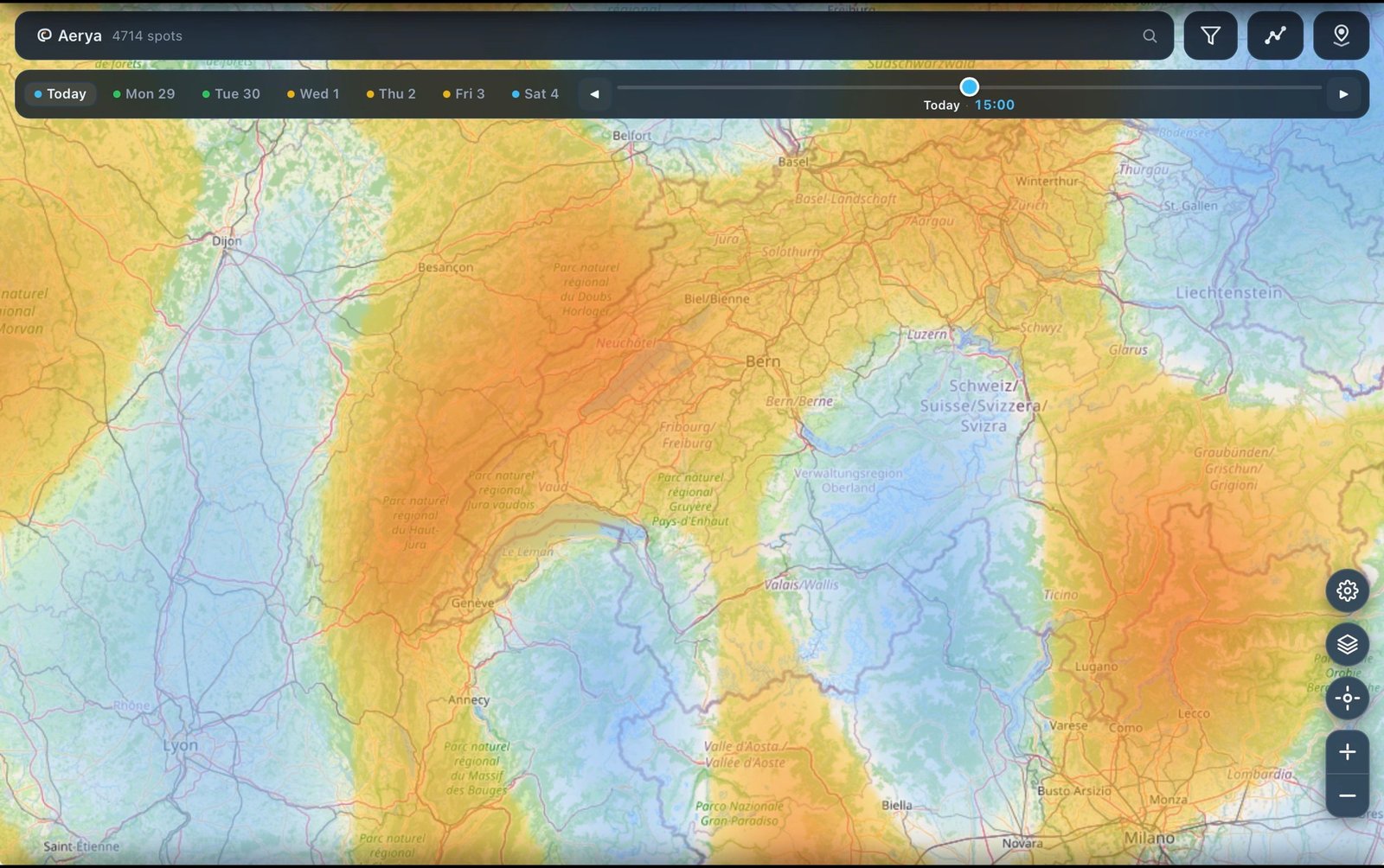
How to spot convergence — before launch
The best time to notice convergence is before you're airborne trying to guess. Here's what to look for:
On the forecast map
Any forecast tool with a convergence overlay (Aerya, XCSkies, RASP, SkySight) will show you exactly where wind fields collide. Look for:
- Sharp linear features — convergence usually forms lines, not blobs. If you see a distinct orange or red line running across the map, that's it.
- Alignment with terrain — the strongest convergence often locks onto a ridge or valley junction. Ridge-aligned convergence is the XC pilot's dream: continuous lift on a predictable route.
- Persistence across hours — click through the hourly forecast. A line that stays in the same place from 12h to 17h is far more reliable than one that jitters around.
On satellite and webcams
Convergence often marks itself in the sky before you launch:
- A line of cumulus that stops abruptly — you're looking at the edge of the moist convergent air.
- Cloud streets aligned in a specific direction — these are convergence bands. Fly parallel to them for miles of easy lift.
- Cumulus building higher along one specific ridge — that ridge is the convergence spine for the day.
How to fly it
Finding convergence is only half the game. The other half is staying in it. A few principles:
1. Fly the warm side
Convergence creates a boundary between two air masses. One side is usually warmer (the one that's been over sunlit terrain), the other is cooler (marine air, or air off shaded terrain). The lift is on the warm side, right against the boundary. Cross to the cool side and you're immediately in sink.
2. Follow the line, don't circle
This is the biggest mental shift from normal thermal flying. In a thermal you circle to stay in the core. In convergence, the lift is a line — you fly along it, straight, and you climb. Circling still works, but it's slow: half of every turn takes you out of the band, so you gain far less per minute than a pilot tracking straight along the line.
Read the line's direction (usually visible from cloud alignment or from the map), turn onto that heading, and just fly. When lift weakens, you've either drifted off the line or the line has ended — S-turn gently to find the strongest band and continue.
3. Base is higher than you think
Convergence lifts air higher than thermals typically manage. Cloudbase over a convergence line is often 500-1000 m above the day's normal ceiling. Don't be afraid to keep climbing when you're used to topping out earlier — the extra altitude is worth the transition penalty.
4. Watch for the line to break
Convergence lines aren't permanent. Sea breezes strengthen and shift inland through the afternoon. Valley winds die at sunset. Synoptic patterns evolve. When lift starts to feel less continuous, more thermal-like again, the line is breaking down. Cash in altitude and glide before it collapses.
Common mistakes
- Treating it like a thermal. Circling in line lift is inefficient — half of every turn takes you out of the band and into neutral or sinking air. Fly the line straight and save the circling for real cores.
- Chasing the darkest cloud. The strongest lift is often just before or alongside the biggest cumulus — where new air is being lifted, not where cloud is already established.
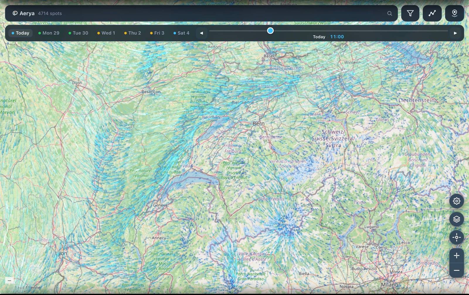
- Ignoring the wind change on either side. When you cross a convergence line, wind direction flips. If your ground track suddenly changes without you turning, you've crossed it. Turn back.
- Overcommitting on synoptic convergence. Big-scale convergence can also mean strong pre-frontal conditions with storm risk. Check CAPE and lifted index before flying deep XC on a strong convergence day.
Putting it together
Convergence flying is what unlocks big days. It's why some pilots seem to fly triangles when everyone else is scratching, and why the same day can produce a 5 km flight for one pilot and a 150 km flight for another. The difference is almost always convergence awareness — spotting it, committing to it, and staying in it.
The good news: unlike thermal reading, which takes years of accumulated feel, convergence is heavily forecastable. A modern forecast with a proper convergence overlay tells you where the lift lines will be, hours in advance. Your job is to look at the map, plan a route that intercepts the line, and go fly it.
See today's convergence lines
Free on iPhone. Convergence, wind, and thermal overlays — no signup required to look.
Download for iPhone →What's next
- Coming soon: Reading the daily thermal cycle — when to launch, when to top out, when to head home
- Coming soon: AROME vs ICON-D2 — which weather model to trust for paragliding
- More Aerya guides →